The Canyon Country Cross of 9 November 2026
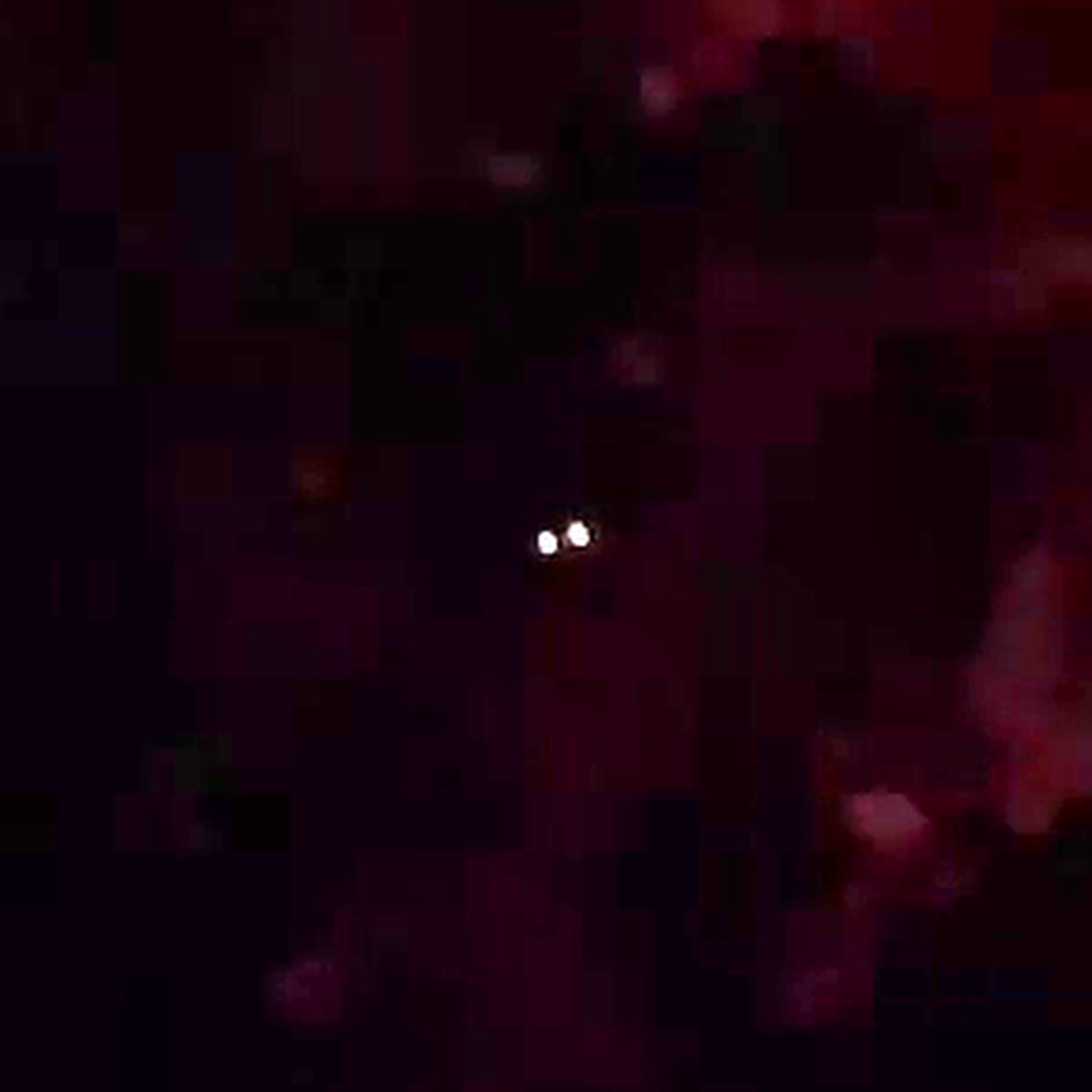
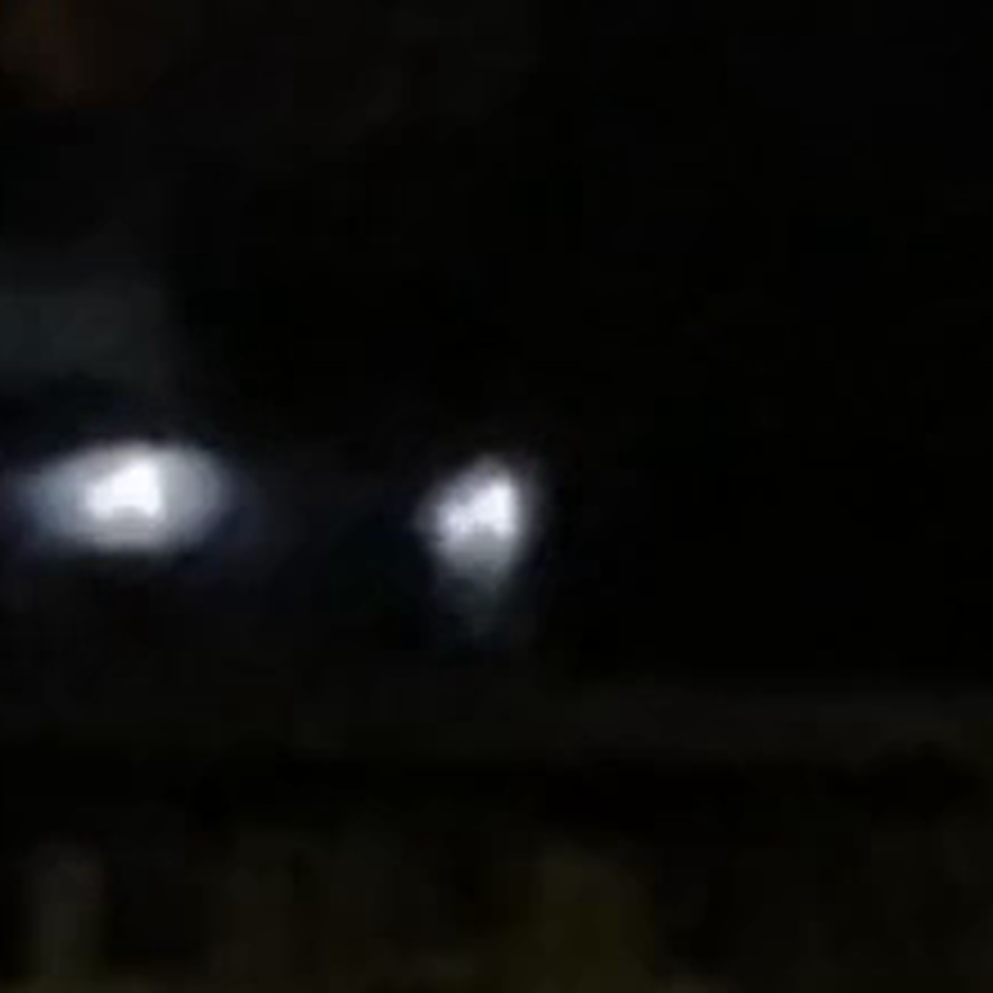
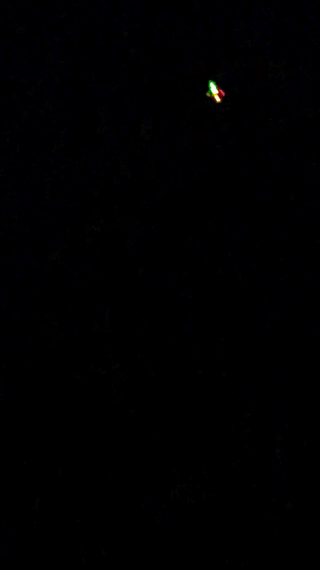
A man sitting on his own front stairs in Canyon Country filmed a cross of lights crossing the sky over the Santa Clarita Valley, filed it through a structured form, and had three separate commenters tell him within hours that it was an aircraft. Enlarged eight times, the object stops being a cross and becomes a set of separate coloured sources, a green on one side, a red on the other, and saturated white and yellow cores between them, which is the standard navigation light arrangement of a conventional aeroplane and which explains the witness's own remark that the lights change colour. The archive treats that as a demonstration of the class of object rather than an identification of any particular aircraft, because two things remain open. The time is disputed between the midnight entered on the form and a commenter's reading of about 7:50 in the evening, and the file the archive serves has had its container rewritten, so it no longer carries the camera timestamp that would settle it.
What did witnesses see at Canyon Country?
A resident of Canyon Country sat on his own front stairs on 9 November 2026 and filmed a cross of lights moving across the sky to his east. He filed the sighting through a structured form as report number 13249, an automated account relayed it to r/UFOs on his behalf, and three separate commenters answered within hours that they were looking at an aeroplane.
The filing records one object, shape cross, closest distance given as as high as a plane, apparent size at arm's length given as a pea, movement given as random and smooth, observer facing east, duration two minutes, one witness, captured on an iPhone 13. Against the five observables the reporter answered yes to wings, no to rotors, unsure on exhaust plume, no to noise, no to sudden extreme acceleration, no to extreme speed with no signatures, yes to hard to observe clearly, no to movement between air, water or space, and no to flight without visible means of lift. On the question of why it could not be a common object he wrote: "It's not a normal plane or drone. It made no noise. Lights were installed unlike any thing I seen before. Play in slow-motion & it's lights change colors." His account of the sighting itself was short and unembellished: "I was sitting on my stairs and seen it come out of nowhere from my right making a curving turn towards my direction just cruising. It was pretty cool."
The published coordinates are not the witness's address. The filing states plainly that the GPS position of 34.43 north, 118.50 west has been randomized to within about 5 kilometres at the reporter's request, so the pin on this map marks a neighbourhood and not a doorstep, and every distance given below carries that same 5 kilometre slack. The point itself resolves through the unauthenticated Census geocoder to Santa Clarita city, Newhall CCD, Census Tract 9200.29, Block Group 1, Block 1009, ZIP Code Tabulation Area 91350, in Los Angeles County, California. The United States Geological Survey elevation service returns 428.22 metres for the same point from its 1 metre raster. That places the sighting in the eastern Santa Clarita Valley, about 13 nautical miles north of Van Nuys Airport, about 16 nautical miles north-northwest of Hollywood Burbank, and about 30 nautical miles north of Los Angeles International.
The media is a single clip. The original file served from the archive's media subdomain is 32,036,201 bytes, 1920 by 1080 landscape, 47.95 frames per second, 25.41 seconds long. The copy that appears on Reddit is 720 by 1280 portrait, so the version most people saw has been cropped or rotated away from the original framing. One detail matters for everything that follows. The container of the original has been rewritten by libavformat, with a major brand of isom and an encoder string of Lavf60.16.100, which means it carries no camera creation timestamp and no Apple metadata at all. The automated block attached to the relay post claims the archive "keeps the untouched original files", and the filing page labels this media an "Original device recording". For this file neither description holds. Whatever the camera wrote, what the archive serves has been through a transcoding pipeline that discarded it.
The object itself is not in doubt. Across 600 tracked samples its apparent area averages 465 pixels, and its contrast against a sky annulus measured at three to five object radii averages 57.2 grey levels. It is plainly a real, bright thing against a genuinely dark sky. No detection significance in sigma is quoted here, and that is deliberate: the surrounding sky is so close to pure black that the measured noise in the annulus collapses toward zero, which makes any signal to noise ratio built on it explode into a meaningless number. The contrast in grey levels is the honest figure, and it is more than sufficient.
What the object does is far less certain than what it is. Its apparent area has a coefficient of variation of 137.1 per cent and its measured aspect ratio swings from 0.13 to 9.19, so the blob is flickering and stretching rather than holding a stable outline. The correlation between apparent area and contrast is 0.123, which is to say essentially none, so there is no recession signature in the clip and nothing in the brightness record indicates the object moving steadily away or toward the camera.
More footage and images of this sighting
What is the official explanation?
No official body has commented on this sighting. There is no police report, no airport statement and no military acknowledgement, and the search for independent corroboration came back empty at every level it was run.
Local first. The Santa Clarita Valley Signal's own site search returns nothing on this event, its most recent item on the subject being a general piece from May 2025 about newly released federal records. KHTS at hometownstation.com has a tag archive for the subject containing exactly two articles, both from 2023. The SCVNews archive for November 2026 was read in full and contains a Veterans Day piece, a school board meeting, a library workshop and a brunch, and nothing about the sky. Regionally the picture is the same: NBC Los Angeles, the Los Angeles Times, the Los Angeles Daily News, LAist and KTLA all carry subject coverage whose newest item predates the sighting, the closest being 22 and 23 October 2026, and none of it is local to Santa Clarita. The ABC7 search index returned no results for the term at all, which is a broken search rather than a negative finding, and it is recorded as unverified.
No second witness exists anywhere. The filing records one witness, nobody in the Reddit thread says they saw it too, and the complete new posts feed of r/SantaClarita back to 23 October 2026 contains no post about lights in the sky of any kind. The reporting service's own archive is the sharpest version of this: filtered worldwide to 7 through 11 November 2026 it returns seven reports in total, one of which is this one, and not one of the other six is from Los Angeles County or anywhere in Southern California on the 8th, 9th or 10th. The nearest in space are a sphere in Santa Barbara County on the 7th and a report from San Francisco on the 8th, and neither resembles this object.
The National UFO Reporting Center can neither corroborate nor refute, and the reason is worth stating precisely rather than filing as a null. Its index was read directly. Searching the city field for Canyon Country returns eleven records whose newest occurrence is 29 September 2022, and Santa Clarita returns nothing later than 6 April 2026, itself explained as a rocket. More tellingly, the index contains no California entries at all for November 2026, the newest in the state being 30 October 2026. That is a publication lag across the whole state, not evidence about this night, and it is treated here as an open question rather than a negative. MUFON's database is not publicly reachable at all.
What exists instead is a set of public instrument records that can be queried for the exact place and both of the candidate minutes, and all of them were pulled for this case.
The Jet Propulsion Laboratory Horizons system, queried as a topocentric observer at the filing's own coordinates and the measured 428 metre elevation, fixes the lighting conditions at both candidate times. Sunset on 9 November 2026 fell at 00:54 UTC on 10 November, which is 4:54 in the afternoon Pacific Standard Time. Civil twilight ended at 5:20, nautical twilight at 5:50, and astronomical twilight at 6:20 in the evening. At the midnight the form records, the Sun stood 71.8 degrees below the horizon. At the 7:50 in the evening the commenter proposes, it stood 36.6 degrees below the horizon, an hour and a half after full astronomical darkness. Both candidate times are fully dark, and the Moon was below the horizon at both, at 76.3 degrees down at midnight and 33.6 degrees down in the evening. The darkness of the sky in the footage therefore cannot be used to choose between them.
The planets do separate the two times, though not in the direction a sceptic of the aircraft reading would want. At midnight, looking east, there genuinely was something bright low in the sky: Jupiter at visual magnitude minus 2.05 and an elevation of 1.52 degrees, and Mars at magnitude plus 0.72 and an elevation of 4.26 degrees, both at an azimuth near 74 degrees and separated by 2.76 degrees. That is a close bright pairing sitting almost exactly where the witness said he was looking. The terrain argues against either being the object. Sampling the United States Geological Survey elevation model outward from the pin along bearings of 074 and 090 degrees gives a local skyline of at least 2.96 and 3.45 degrees respectively, set by ridges within a kilometre of the observer, which places Jupiter below the visible horizon and leaves Mars barely clearing it. That calculation rests on thirteen sampled points and on a pin that is itself randomized by about 5 kilometres, so it is an indication rather than a proof. At 7:50 in the evening the question does not arise at all, because Jupiter, Mars and Venus were all well below the horizon and the only bright planet in the sky was Saturn, at magnitude plus 0.51 and 51.4 degrees up in the south-southeast, nowhere near the eastern sky the witness was watching.
The filing carries an automatically generated sky context block which states that "No bright satellites were visible overhead" and attributes that to orbital data from the 2026-11-09 catalogue. That block should not be given any weight here, and the reason is the whole problem with this case in miniature. It was computed against the time the form holds, which is the midnight this case finds to be the less likely of the two candidates. If the capture actually happened at about 7:50 in the evening, the automated check was run for a minute almost twenty hours away from the event, and it says nothing about what was overhead when the camera was rolling. It is an automated lead computed from a disputed input, not a finding.
The weather can be dismissed cleanly. The Iowa Environmental Mesonet archive of routine and special surface observations returns, for Hollywood Burbank, Van Nuys and General William J. Fox Airfield at Lancaster, a sky condition of CLR and a visibility of 10 statute miles for every hourly observation through 9 November 2026 local time, without exception. The sky was clear and the visibility unrestricted at both candidate times, at all three stations surrounding the valley. Nothing in the footage can be blamed on cloud, haze or an obscuration, and equally the weather offers no help in choosing between midnight and the evening.
The airspace record is where the public documentation becomes specific. Canyon Country sits under one of the busiest terminal areas in the United States, and the relevant question is not whether aircraft cross it but whether a published procedure would put one into a turn over it. One does. Federal Aviation Administration chart AL-67, the FERNANDO SEVEN ARRIVAL, coded FIM.FERN7, was in effect for the SW-3 volume from 29 October 2026 to 26 November 2026, a window that contains the night of the sighting. Its transitions from Avenal, Fellows, DERBB and OHIGH all converge on the Fillmore VORTAC, and from there the chart's route description reads, for one of its branches: "LANDING VAN NUYS RUNWAY 16: Via FIM R-053 to UMBER INT, then via I-VNY localizer. Expect ILS RWY 16R."
UMBER intersection lies at 34 degrees 28 minutes 49.230 seconds north, 118 degrees 30 minutes 57.690 seconds west. That is 5.79 kilometres north-northwest of the published pin, inside the slack of the coordinate randomization. Checking the chart against the geometry confirms the reading: Fillmore to UMBER is 19.6 nautical miles on a true bearing of 67.7 degrees, which with local magnetic variation is the charted R-053, and UMBER to Van Nuys is 16.3 nautical miles on a true bearing of 175.4 degrees, which is the Van Nuys runway 16R localizer course. An aircraft flying that branch arrives over the Santa Clarita Valley heading northeast, and at UMBER it turns right through roughly 108 degrees onto a southbound final approach course. The turn happens over Canyon Country. There is, in other words, a charted, currently effective instrument procedure whose entire purpose is to swing arriving traffic through a large curve directly above the area in question, and a second one at Van Nuys is named NEWHALL TWO after the neighbouring community. The Van Nuys entry in the Chart Supplement adds that departures from runways 34L and 34R, which climb north toward this same valley, may make no turns before reaching 1,800 feet above sea level unless air traffic control directs otherwise.
None of that identifies a flight, and this case does not attempt to. It establishes only that turning traffic over Canyon Country at low to moderate altitude is routine and published rather than unusual.
What did the witnesses think it was?
The reporter is a verified submitter. The relay account states that he confirmed the submission from his own Reddit account through a one-time link, so the name attached to the filing is the name of the person who filed it. Nothing in his conduct suggests invention. His written account is two sentences long, claims nothing exotic, and ends with "It was pretty cool" rather than with an interpretation. His own answers work against the extraordinary reading as often as for it: he answered no to sudden extreme acceleration, no to extreme speed with no signatures, no to flight without visible means of lift, no to movement between air, water or space, and yes to hard to observe clearly. He also answered yes to wings.
That last answer matters more than it looks. The two observations the witness volunteered without prompting, that the object had wings and that in slow motion its lights change colour, are precisely the two things a conventional aircraft seen at night produces. He recorded them accurately. What he did not do was join them up.
The thread answered him quickly and bluntly. u/winfryd, whose comment drew the most support in the thread, wrote only "first time seeing a plane?" A fourth account, u/Much_Walrus_8513, replied underneath it with "Wasn't sure. Thanks for clarifying." followed by a trailing emoji and a laugh, which reads either as the person who filmed it conceding the point or as sarcasm aimed back at the snark, and the archive cannot tell which, since the verified filer posts under a different handle.
u/AssRep was more specific: "Um, that is an airplane with LED strips/sheets attached to its fuselage and/or wings. Sorry, OP, but this one was easy."
That is very nearly the whole thread. The post drew seven comments and carried a score of zero. Of the remaining entries, one was an off-topic solicitation unrelated to the sighting which was downvoted and later removed by the subreddit moderators, and one was deleted. So the substantive response to this report consisted of four comments, three of which independently said aircraft, and none of which said anything else.
u/R2robot did the most actual work, and his comment is the one that set the terms of this case. He wrote: "Looks like a plane. The meta data says it was more like 7:50PM, not midnight. Can you confirm that? There would have been a fairly low flying plane over the area at the time." He attached two images. He then added that this type of jet "seems to have more downward facing lights than most as you can see from the ones shining on the ground here", and finished with "Duplicate those to the other side as well and I suppose it is kinda 'cross' shaped".
Both images were retrieved and examined here rather than taken on description. The second is a night photograph of a Bombardier Global series business jet on a ramp, with its downward facing lights throwing bright pools onto the tarmac. It is a generic illustration of that type's lighting, not footage of the event, and his description of it is accurate.
The first image is more consequential than its author claimed, and it also fails in a way he did not notice. It is a screenshot of an ADS-B Exchange historical playback showing a specific aircraft over the Santa Clarita Valley: callsign EJA155, Mode S hex A0DE31, registration N155QS, type GLEX, a Bombardier BD-700 Global 6000 or 6500, squawking 4734, groundspeed 217 knots, barometric altitude 4,850 feet, vertical rate zero, track 013.6 degrees, position 34.437 north, 118.607 west. The Federal Aviation Administration registry confirms N155QS as a Bombardier BD-700-1A10, serial 9832, fixed wing multi-engine turbofan, with Mode S hex A0DE31, status valid. The hex in the FAA record matches the hex in the screenshot exactly, which means the screenshot is a genuine record of a real registered aircraft and not something assembled. The registry withholds the registered owner under Title 49 of the United States Code, section 44114, so the operator name shown on the screenshot comes from the ADS-B Exchange database rather than from the government record, and the archive has not pursued the ownership question, which is irrelevant here.
The failure is geometric. That aircraft's plotted position lies on a bearing of 274.6 degrees from the published pin, 9.84 kilometres away, at an elevation angle of about 6 degrees. That is very nearly due west. The witness recorded himself facing east. A 5 kilometre randomization cannot turn a 9.8 kilometre westward offset into an object in the eastern sky, and the aircraft's 013.6 degree track carries it further north rather than across to the observer's east. A Global 6000 at that slant range subtends 0.166 degrees, roughly a quarter of the pea at arm's length the witness estimated. The screenshot also carries no visible date or time, so the minute the playback was set to cannot be confirmed from the image.
One point should be made in the other direction, because it is the strongest thing that can be said for the identification. The witness, facing east, said the object came from his right, which means from the south, and the aircraft's 013.6 degree track has it moving northward, approaching from the south. That part fits. What does not fit is where it was while doing so, and bearing is what determines where a thing appears in the sky. An object approaching from the south along a line nearly 10 kilometres west of the observer is behind his left shoulder, not in front of him.
Read carefully, R2robot did not claim otherwise. His sentence is that there "would have been a fairly low flying plane over the area at the time", which is a demonstration that qualifying traffic was present, not an identification of the object. This archive reads it that way, and does not adopt that aircraft as the thing in the video.
Is the Canyon Country Cross of 9 November 2026 real? The two-pass assessment
Pass one, how this could be entirely ordinary.
The decisive observation is not the one the commenters made, and it does not depend on them being right about anything. Enlarged eight times, the object stops behaving like a single light and resolves into separate coloured sources. There is a distinct green source on one side, a distinct red source on the other, and saturated white and yellow cores between them. That is the standard navigation light configuration of a conventional aircraft: green on the starboard wingtip, red on the port wingtip, white landing and tail lights in between. It is not a configuration that a planet, a satellite, a balloon or a distant drone produces, because the colours are spatially separated on opposite sides of a lit structure rather than being one source changing hue.
Two independent things fall into place around it. The witness himself wrote that if you play the clip in slow motion "it's lights change colors", which is exactly what a viewer sees when separate red and green sources are too small to resolve and alternately dominate a flickering blob. And he answered yes to wings on a form that gave him every opportunity to say otherwise. The measurement and the witness's own two volunteered observations describe the same object, and they agree.
The cross shape follows from the same geometry without needing anything added. A wing line of lights crossed by a fuselage line of lights, with downward facing lights beneath, reads as a cross at the limit of resolution, which is the point R2robot made from a photograph of the type before any of this was measured.
The context supports it at every level that can be checked. The sky was clear with 10 statute miles of visibility at all three surrounding stations throughout the day. The witness's own estimates of the object are an aircraft's estimates: he put it at the distance of a plane, gave it wings, heard no noise, and reported no acceleration, no unusual speed and no absence of visible lift. A pea at arm's length is roughly 0.7 to 0.8 degrees, which a narrowbody airliner's wingspan subtends at a slant range near 2.5 to 2.9 kilometres and a large business jet at 2.0 to 2.3 kilometres, in other words at the sort of altitude the witness himself named, though naked eye angular estimates of lights at night are unreliable enough that this is a consistency check and not a measurement. Above all, the airspace is not ambiguous. A charted arrival in effect that very week turns Van Nuys traffic through 108 degrees at a fix less than 6 kilometres from the pin.
Pass two, what genuinely remains open, and it is more than the first pass would suggest.
The time is unresolved, and it is unresolved because of the archive, not because of the witness. The form says midnight Pacific, which is both a real answer and the most common default value a time field can hold. A commenter says the file's metadata read about 7:50 in the evening. That cannot be adjudicated against the file the archive serves, because the container of that file has been rewritten by libavformat and carries no camera creation timestamp and no Apple metadata whatsoever. The one artifact that should have settled the question has been stripped of the field that would have settled it, by the archive's own pipeline, while that pipeline's relay post advertises untouched originals.
What can be established points firmly, without closing the matter. The filing page's own structured data gives the media an upload time of 03:57:04 UTC on 10 November, and the Reddit relay post was created at 03:57:04 on the same date, agreeing to the second. Both are 7:57 in the evening Pacific on 9 November. That is seven minutes after the time the commenter read off the metadata, and nineteen hours and fifty-seven minutes after the midnight on the form. A person who films something and files it immediately produces exactly this pattern. The honest limit is that an upload time bounds a capture time from above and does not fix it, since nothing stops someone filming at midnight and filing that evening. The evening reading is much the better supported of the two, and the midnight entry has the shape of a default, but the case does not treat the time as settled.
The motion cannot be tested at all, and no claim about it survives in either direction. Phase correlation across the clip returned a median peak of 0.224 with the frame unmasked, which collapsed to 0.043 once the object was masked out. By this archive's standing method that means the correlation was locking onto the object itself rather than onto background structure, so camera motion cannot be recovered. The witness's curving turn can be neither confirmed nor refuted, and neither can any suggestion that the object moved in a way an aircraft could not. Anyone asserting either is asserting beyond the data. The same limitation bites harder still: a background subtracted frame median peaked at minus 0.00 against a per pixel noise floor of 2.15, meaning there is no static reference anywhere in the frame, no star field, no rooftop, nothing. Without a plate solve there is no angular size and no angular rate, so the object's true size and speed are simply not available, and the large swings in apparent area and aspect ratio are as likely to be a handheld phone and a flickering blob as anything about the object.
The one specific aircraft that has been offered does not fit. The ADS-B record in the thread is genuine, and the FAA registry confirms its Mode S hex to the character, but it plots nearly due west of the pin while the witness was facing east, and the coordinate randomization is not large enough to rescue that. It demonstrates that qualifying traffic was over the valley. It does not identify the object, and this case does not say that it does.
There is no corroboration of any kind. No second witness, no local news, no regional coverage, nothing outside the reporting service and one short Reddit thread.
On the tier. Strongly Disputed is used here rather than Disputed because the navigation light geometry is a direct measurement of the class of object rather than an inference from plausibility, and because it is independently corroborated by two things the witness wrote down himself before anyone analysed anything. That is strong enough to say what kind of thing this is. It is deliberately not strong enough to say which aircraft it was, and the case does not claim to, because the time is unresolved and no playback has been run against a confirmed minute and an actual line of sight.
One check would close this case, and it is cheap. Historical ADS-B playback for the corrected minute, run once the capture time has been established, and matched against the line of sight from the observer's real position rather than the randomized pin. The reporter can supply both: the untouched file from his own phone, which still carries the camera timestamp the archive's copy has lost, and his actual location. Until then this stays where it is.
A final point, because it is the archive's standing position and it applies squarely here. Nothing in this file suggests the witness did anything wrong. He saw something at night, filmed it, answered a long form carefully and conservatively, recorded two details that turned out to be the key to the whole thing, and described what he saw without embellishment. An honest reporter, plus genuine footage, plus a misidentification, is not a hoax. It is the ordinary and expected outcome of a member of the public looking up under one of the busiest pieces of airspace in the country, and it is worth more to this archive than a dozen untestable stories.
A later pass over the published charts found a better match than the Van Nuys arrival discussed above, and it sits in the direction the witness was actually looking. KIMMO intersection lies 4.3 nautical miles from the pin on a true bearing of 106 degrees, which is essentially due east. It is a charted turn fix on two separate procedures, both crossing it at 7,000 feet. On the KIMMO THREE ARRIVAL into Los Angeles and Santa Monica, traffic off the Palmdale transition reaches KIMMO inbound on a 218 degree course and turns left onto 139 degrees, a turn of roughly 79 degrees. On the VVERA TWO departure out of Burbank and Van Nuys, traffic crosses KIMMO climbing and turns right from 003 degrees onto 041 degrees. From a seat in Canyon Country facing east, either one is an aircraft that crosses the eastern sky and visibly changes heading, which is what the witness described as coming out of nowhere from his right and making a curving turn. Both procedures carry restrictions, the KIMMO THREE to non-turbojet aircraft and the VVERA TWO to turboprops, so neither is high volume, and no specific flight is asserted here.
The same chart set adds a piece of ordinary context that matters more than any single procedure. The Federal Aviation Administration's Los Angeles terminal area chart for the cycle covering this night prints a caution box directly over the city reading intensive flight training, Santa Clarita, with advisory frequencies for traffic below 4,500 feet and at or below 2,000 feet, and it runs a visual flyway corridor marked 8000 and below north-east to south-west through the northern Santa Clarita Valley. Low aircraft over this specific valley are not an unusual event that needs explaining. They are a charted, continuous condition.
One measurement cuts the other way and belongs on the page. The witness put the object's apparent size at a pea held at arm's length, which is roughly 29 to 39 arcminutes, or about one Moon diameter. An airliner with a 35 metre wingspan at KIMMO, 7,000 feet up and 4.3 nautical miles out, subtends about 15 arcminutes, noticeably less than half that. Only an aircraft very nearly overhead at 6,000 to 7,000 feet reaches pea size. Recalled apparent size is among the least reliable fields on any sighting form and nothing here rests on it, but the honest position is that the eastern procedural traffic would have looked smaller than the witness remembers, and that gap is not closed.
Sources
- ufosighting.report/sighting/13249/cross-shaped-object-cruised-smoothly-in-curving-path-over-ca
- www.reddit.com/r/UFOs/comments/1xsd13a/crossshaped_object_cruised_smoothly_in_curving/
- media.ufosighting.report/uploads/2026/11/e51245a202e44aed90b5471bfc2bb5b3.mov
- ssd.jpl.nasa.gov/api/horizons.api
- mesonet.agron.iastate.edu/cgi-bin/request/asos.py?station=BUR&data=skyc1&data=skyl1&data=vsby&year1=2026&month1=11&day1=9&year2=2026&month2=11&day2=10&tz=America%2FLos_Angeles&format=onlycomma&report_type=3&report_type=4
- geocoding.geo.census.gov/geocoder/geographies/coordinates?x=-118.50&y=34.43&benchmark=Public_AR_Current&vintage=Current_Current&layers=all&format=json
- epqs.nationalmap.gov/v1/json?x=-118.50&y=34.43&units=Meters&wkid=4326
- www.aopa.org/ustprocs/20261029/SW-3/vny_fernando_seven_cont1.pdf
- opennav.com/waypoint/US/UMBER
- www.airnav.com/airport/KVNY
- www.airnav.com/airport/KBUR
- registry.faa.gov/AircraftInquiry/Search/NNumberResult?nNumberTxt=155QS
- i.imgur.com/KisNkHA.png
- i.imgur.com/SuKgqpj.png
- www.signalscv.com/?s=UFO
- aeronav.faa.gov/d-tpp/2611/00237KIMMO.PDF
- aeronav.faa.gov/d-tpp/2611/00067VVERA.PDF
- aeronav.faa.gov/d-tpp/2611/00067JANNY.PDF
- aeronav.faa.gov/visual/10-29-2026/PDFs/Los_Angeles_TAC.pdf
More cases from this region: UFO sightings in United States